Nova Kakhovka Dam Breach: Before And After Satellite Images Reveal Destruction
Updated
- By RFE/RL
Satellite images taken before and after the destruction of the Nova Kakhovka dam show the catastrophic impact of the extensive flooding caused by the collapse of the structure that spanned the Dnieper River in southern Ukraine.
Before
After
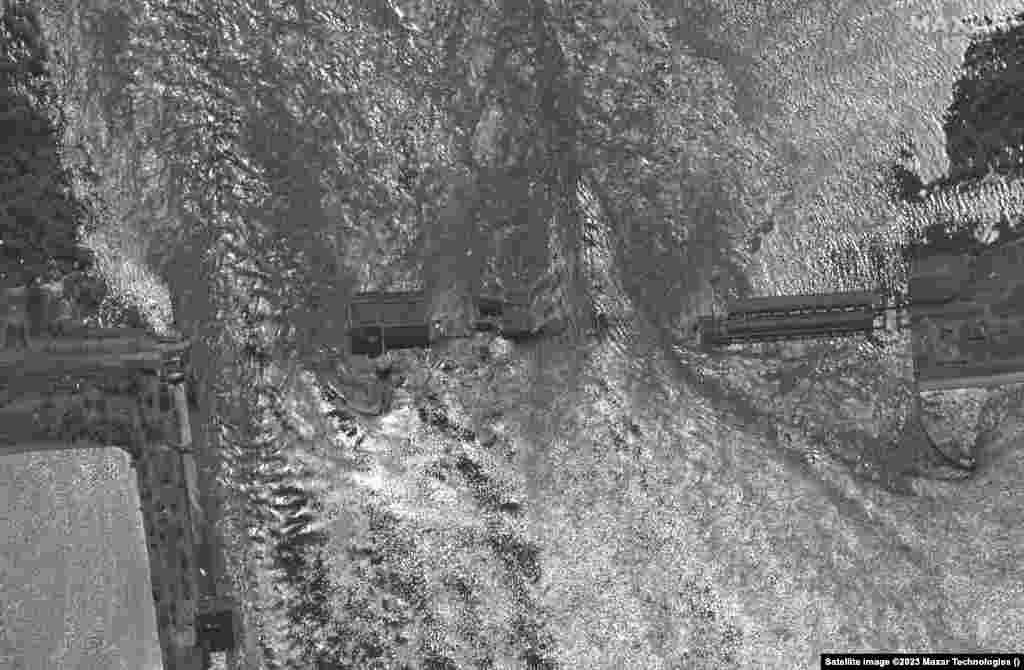
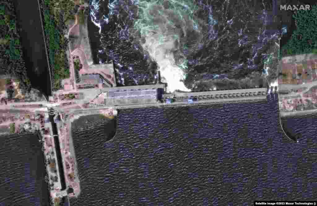
1
Satellite images show the Russian-controlled Nova Kakhovka dam on June 5 and the same area on June 6 after it was breached.
Before
After
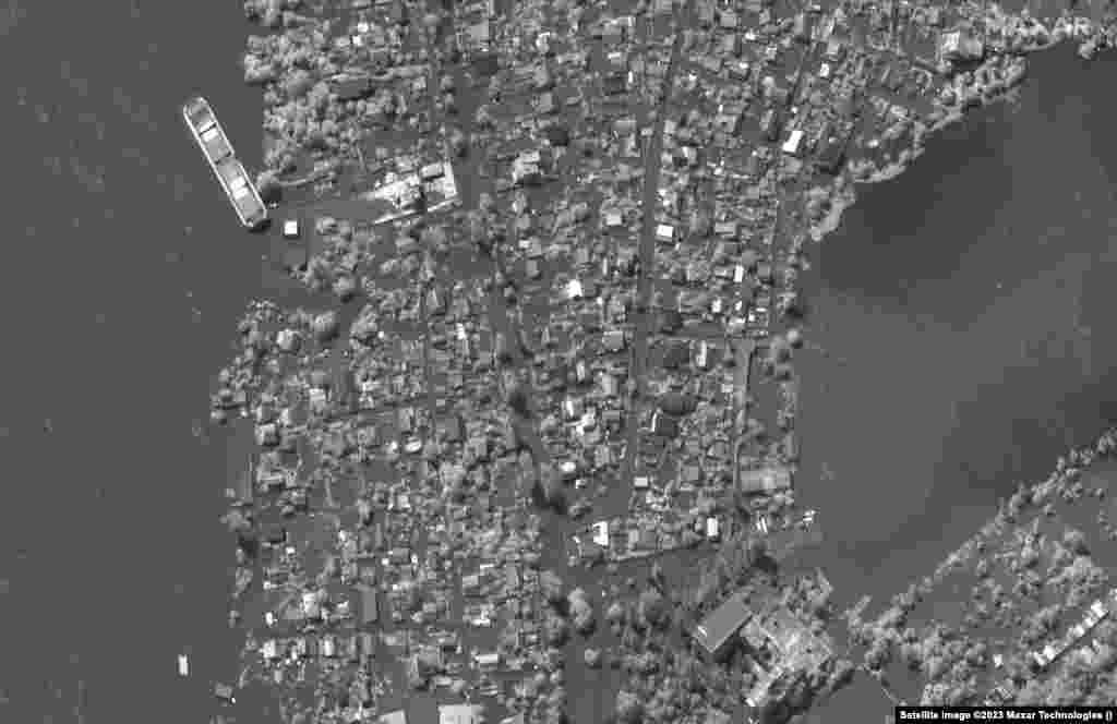
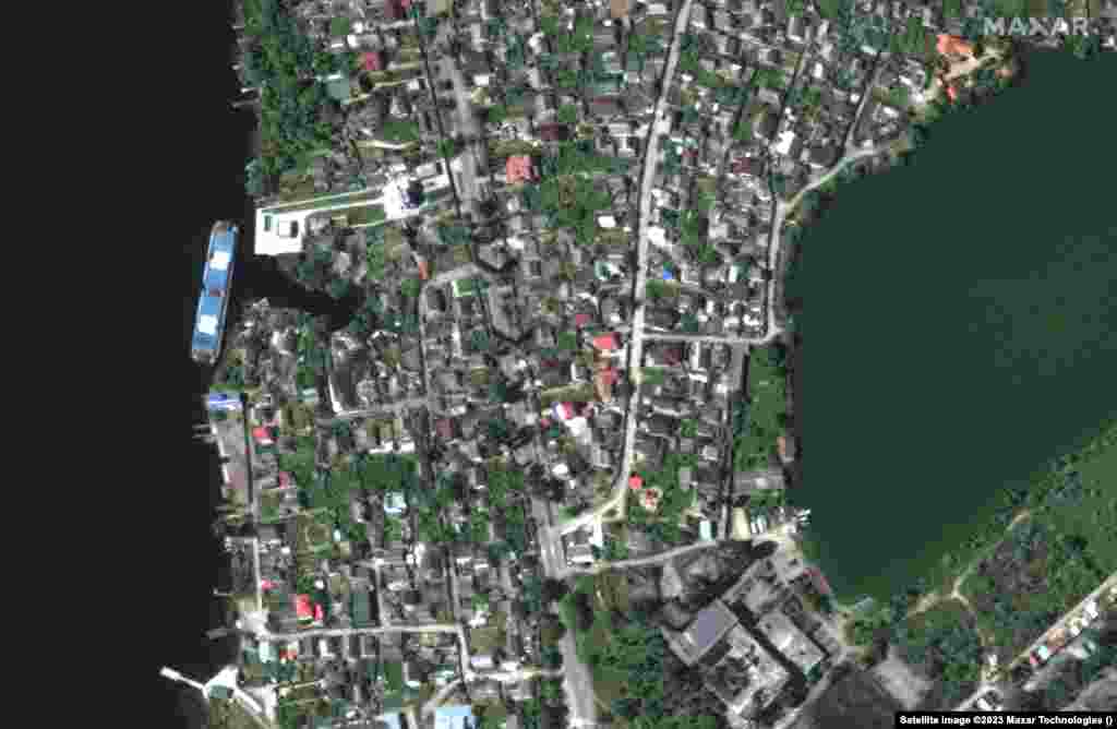
2
A May 15 image captures homes along the Dnieper River near Kherson followed by the aftermath of flooding on June 6 due to the breach of the Nova Kakhovka dam.
Before
After
3
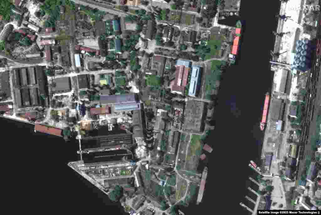
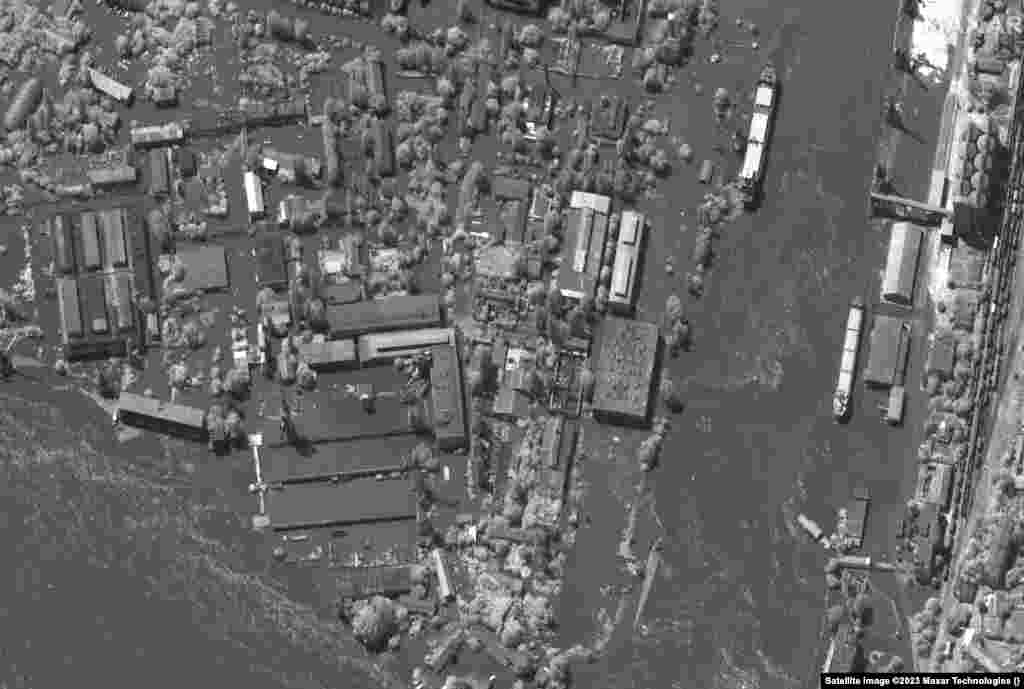
A May 15 image shows the port facilities and industrial area of Kherson and the aftermath of flooding on June 6.
Before
After
4
A May 15 image shows the Russian-occupied town of Nova Kakhovka followed by the aftermath of the flooding.
Before
After
5
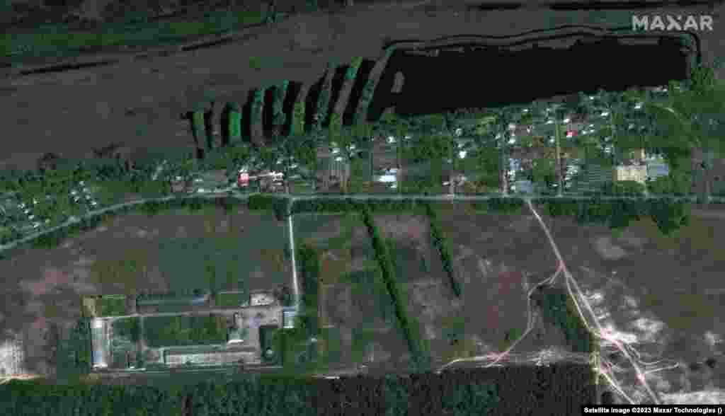
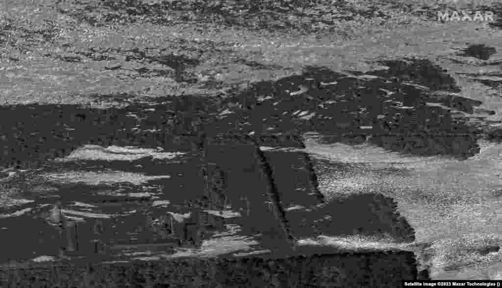
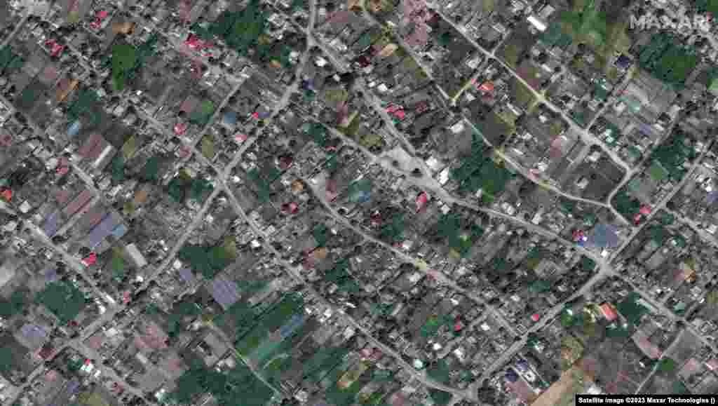
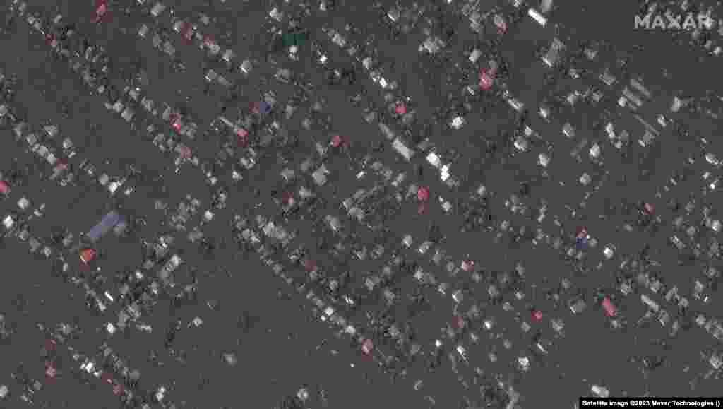
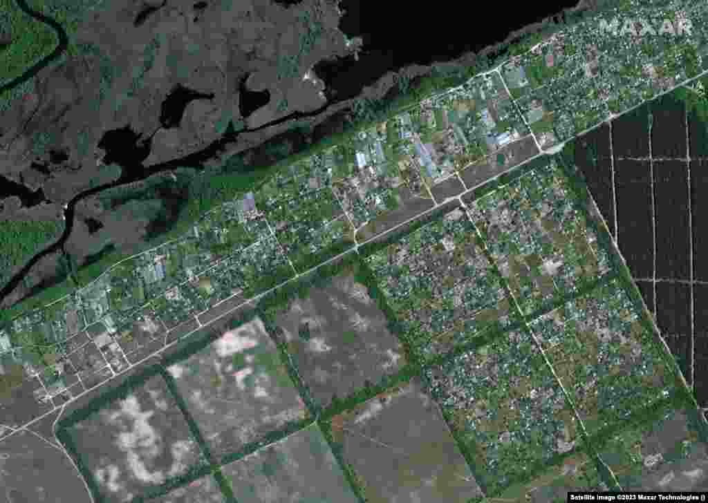
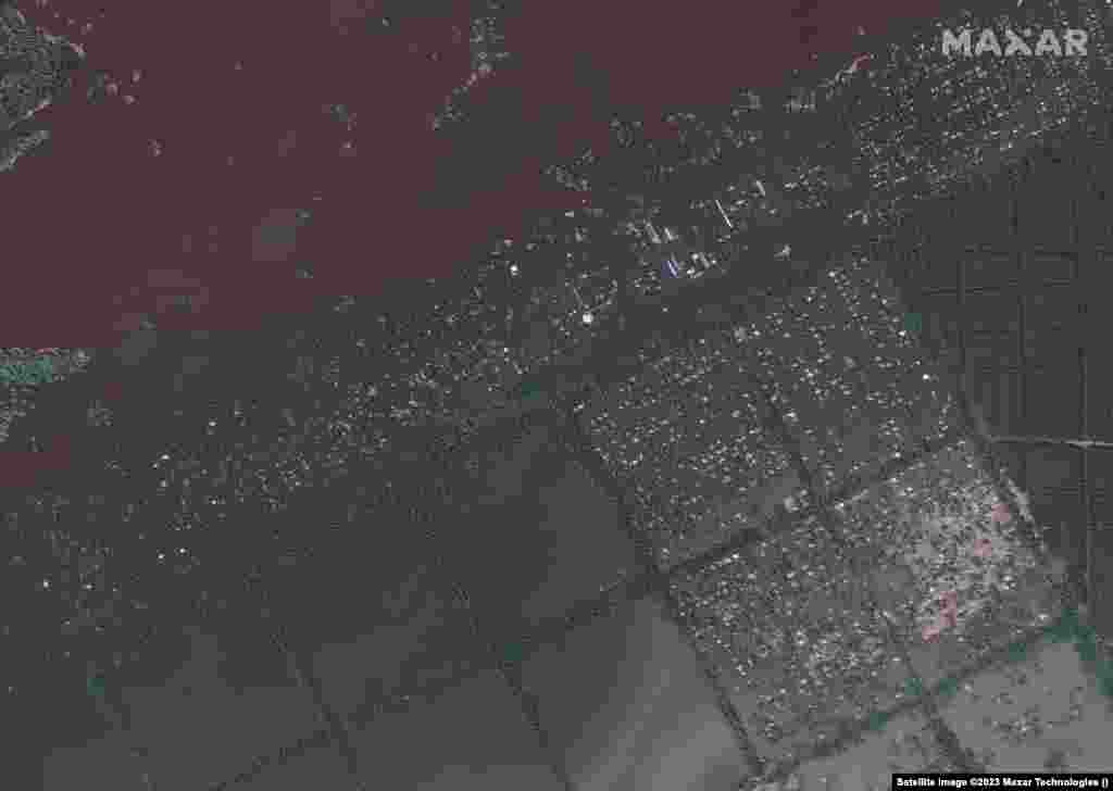
A May 15 image captures the village of Korsunka followed by an image showing the impact of the deluge.
Before
After
6
Another view of the village of Korsunka, which was inundated by floodwaters.
Before
After
7
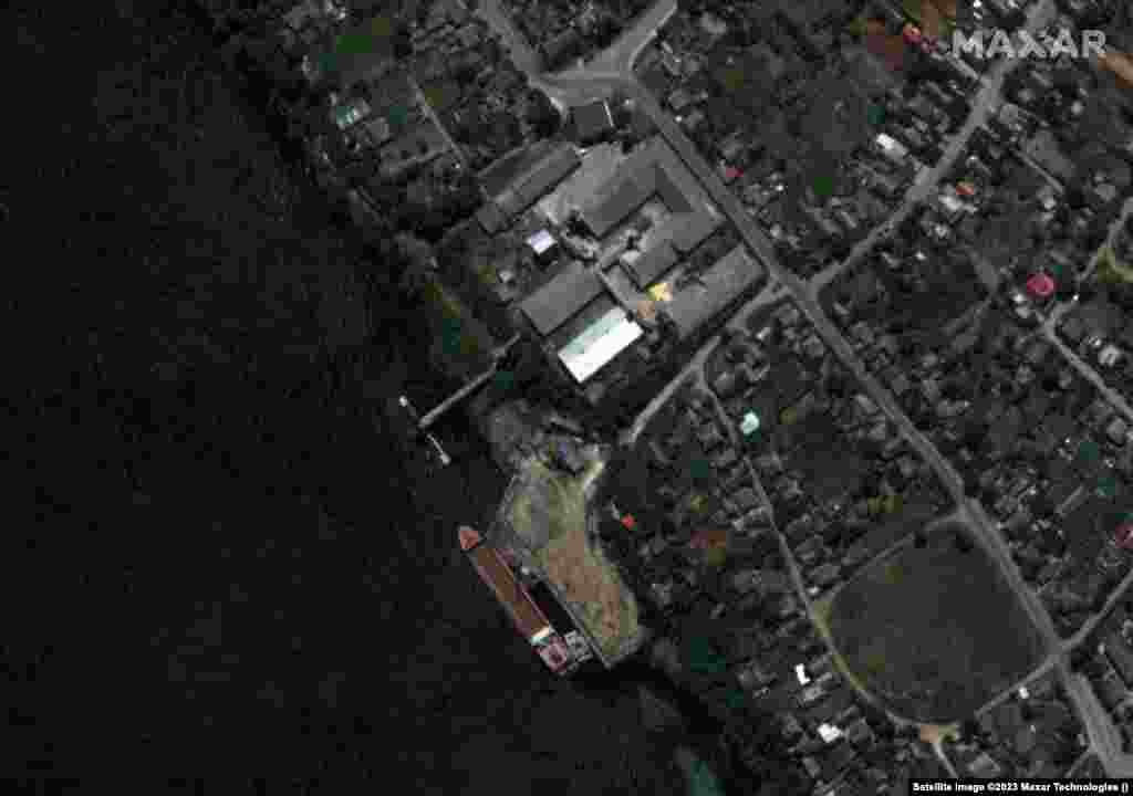
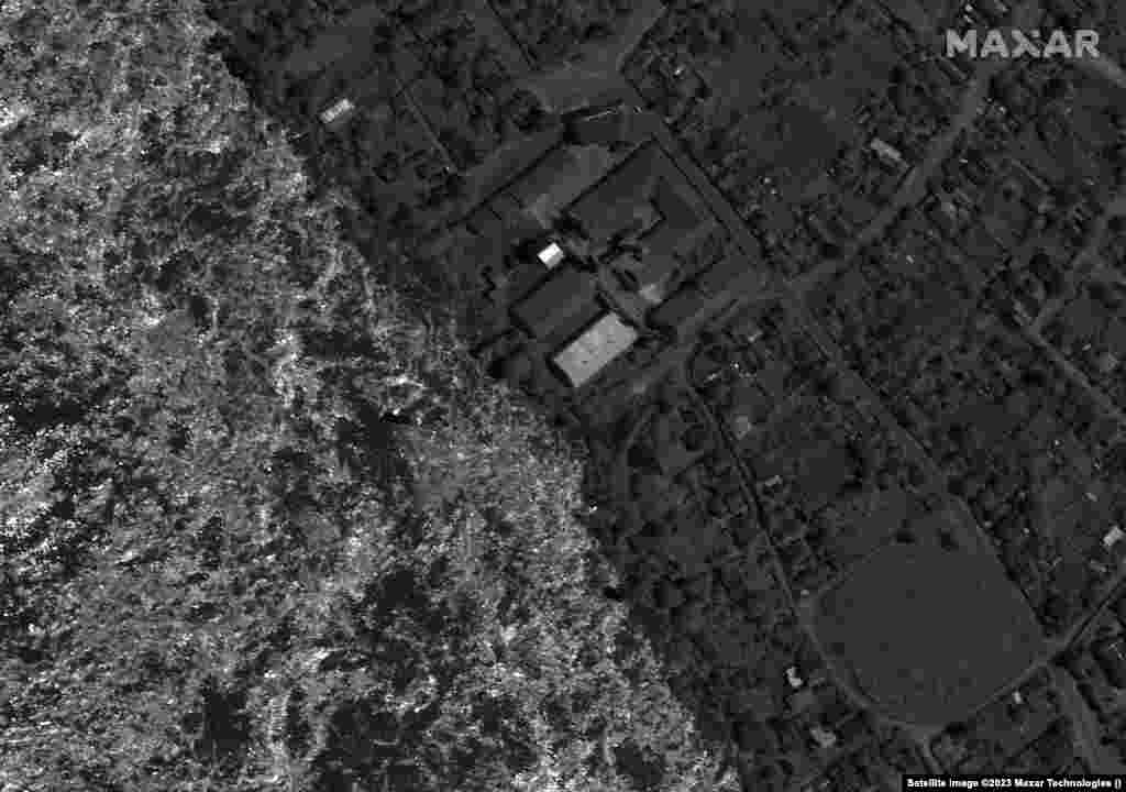
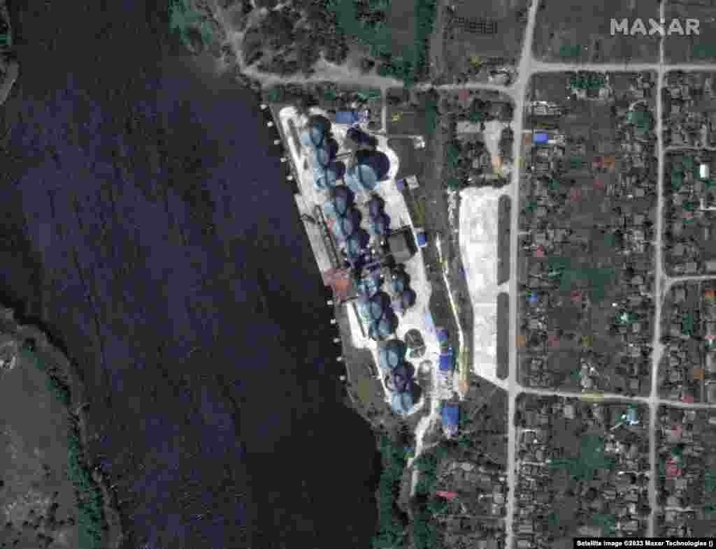
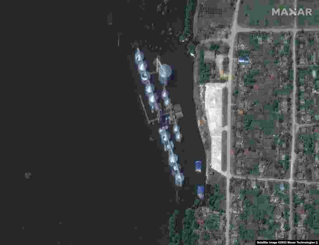
A view of the granary in Nova Kakhovka on June 5 and following the inundation on June 7.
Before
After
8
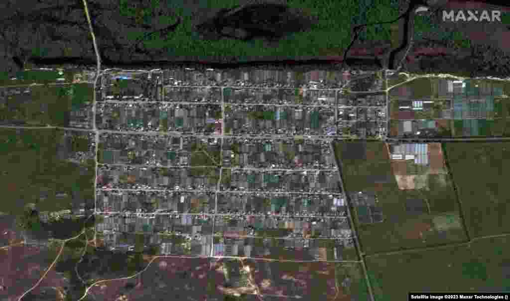
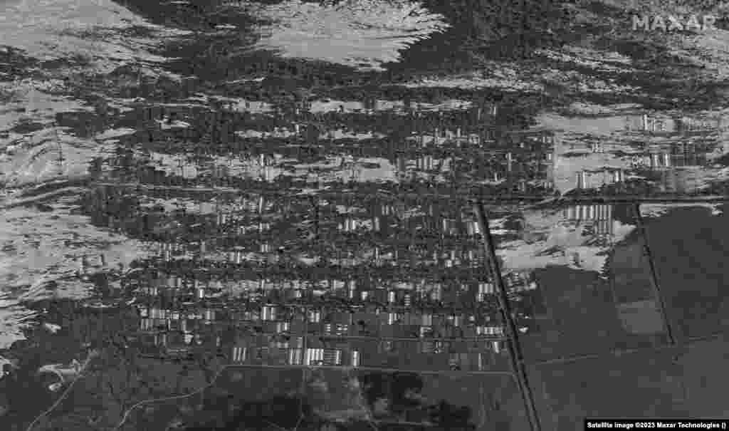
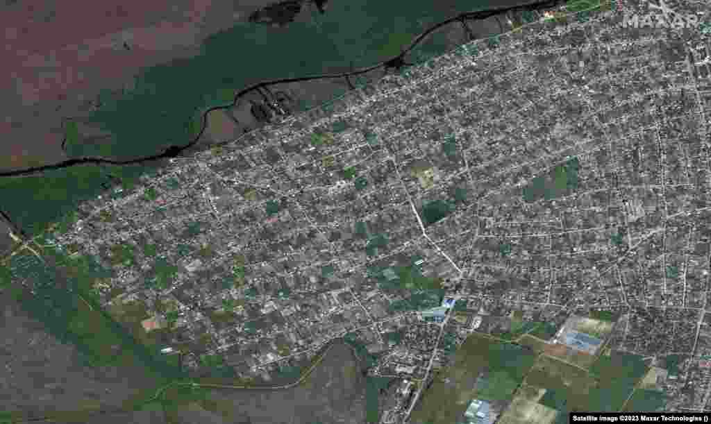
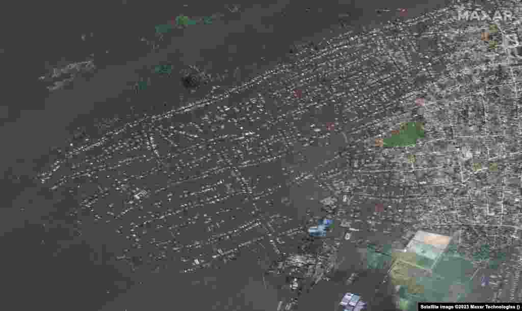
The town of Oleshky on May 15 and the aftermath on June 7.
Before
After
9
Another view of the town of Oleshky from May 15 and the aftermath on June 7.
Before
After
10
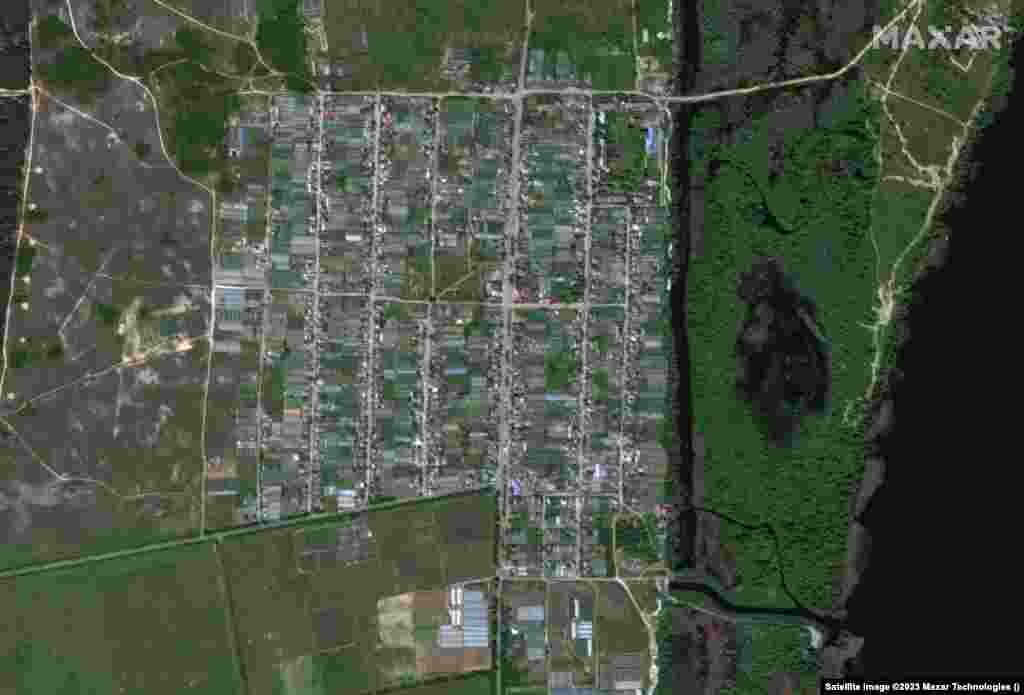
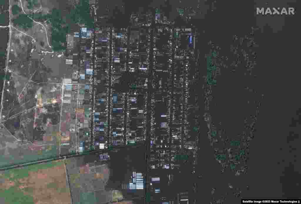
A view of Korsunka from May 15 and following the flooding on June 7.
Before
After
11
A view of Nyzhnya Krynka from May 15 and June 7.