Satellite images collected during the course of a year by NASA and the National Oceanic and Atmospheric Administration (NOAA) provide a vivid depiction of worldwide vegetation.
According to a NOAA report, although 75 percent of the planet is a relatively unchanging ocean of blue, the remaining 25 percent of the Earth’s surface is a dynamic green. (5 PHOTOS)
NASA Maps The Earth's Vegetation
1
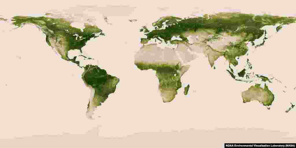
Satellite data from April 2012 to April 2013 were used to create this image. Dark green areas are lush in vegetation, whereas pale colors are more sparsely covered.
2
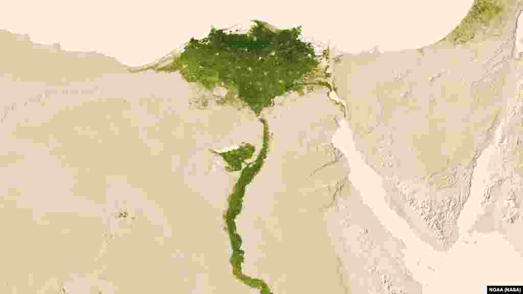
Amidst the deserts of Egypt, the Nile River provides life-sustaining water to the region. Also visible are the urbanized areas of northern Egypt, based on satellite imaging data taken July 9-15, 2012.
3
The Tigris (north) and Euphrates (south) rivers create a fertile crescent through central Iraq. The images were taken November 12-18, 2012.
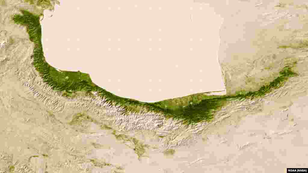
4
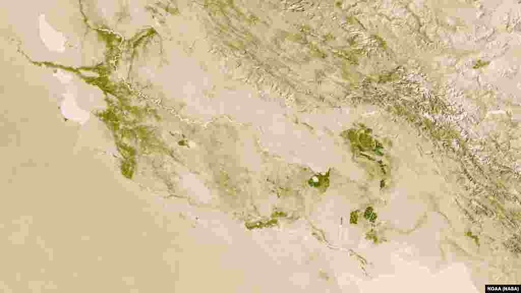
Moisture from the Caspian Sea precipitates on the northern edge of the Elburz Mountains; on the southern edge, deserts emerge in the rain shadow. Images taken November 5-11, 2012.
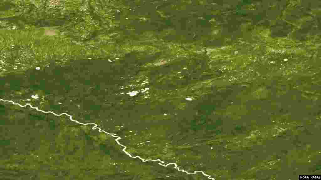
5
Dense boreal forest in central Russia before wildfires near the Russian town of Langepas. Images collected June 18-24, 2012.